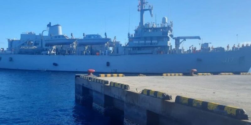
A Hydrographic survey has begun in Ihavandhippolhu.
The survey is conducted collaboratively by Maldives Hydrographic Service, MNDF Coast Guard and India’s National Hydrographic Office started on January 23, 2023.
Maldives Hydrographic Service stated that the survey will continue until February 28. Joint teams will be deployed in the area using small boats for the survey and activities will also be carried out along with GPS receivers to draw the coastline of the islands. Also, MNDF Coast Guard Vessels and soldiers will be part of the survey team.
Moreover, Maldives Hydrographic Service stated that the charts currently used in the country are surveyed and compiled by the British Admiralty hundreds of years ago. Therefore, it can be seen that these charts contain a large number of areas that do not occur from the GPS position.
The main purpose of the survey according to Maldives Hydrographic Service is re-survey the Ihavandhippolhu Atoll to meet current International standards and create a new chart. In addition, the Maldives Hydrographic Service noted that they will continue to create new charts to update the currently used charts in the Maldives in the future.
So far as part of the Hydrographic survey conducted in the Maldives, large area of country’s territorial waters has examined.


 in #Thiladhunmathi
Comments