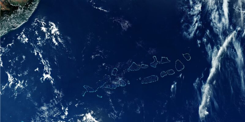
NASA Satellite Copernicus Sentinel – 3 has captured some stunning pictures of the atolls of the Maldives.
The exquisite finished off like small pearls in the heart of Indian ocean, the picture captured an extravagant picture with wide angle with the capability of 1270km wide!
The main mission of this satellite is to assist the worlds climate scientists on collecting data all around the world with the considerable changes faced in the world. One such data accumulated by the satellite is to check and record the sea level rise in different oceans. It also tries to get land and sea surface temperatures as well.
This image taken by Copernicus EU #Sentinel-3 on 29 March shows all 1200 islands that make up the Republic of Maldives….
Posted by ESA – European Space Agency on Saturday, October 31, 2020
SENTINEL-3 makes use of multiple sensing instruments to accomplish its objectives as well. They are:
- SLSTR (Sea and Land Surface Temperature Radiometer)
- OLCI (Ocean and Land Colour Instrument)
- SRAL (SAR Altimeter)
- DORIS (Doppler Orbitography and Radiopositioning Integrated by Satellite)
- MWR (Microwave Radiometer).
The mission will support ocean forecasting systems, as well as environmental and climate monitoring. Sentinel-3A was launched on 16 February 2016 and Sentinel-3B will join its twin in orbit on 25 April 2018.


 in #Thiladhunmathi
Comments